

Question: - The map below, shows the elevations in a coastal area. - Construct a contour map. Use a contour interval of 20 feet (REMEMBER YOUR
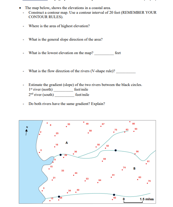
- The map below, shows the elevations in a coastal area. - Construct a contour map. Use a contour interval of 20 feet (REMEMBER YOUR CONTOUR RULES). - Where is the area of highest elevation? - What is the general slope direction of the area? - What is the lowest elevation on the map? feet - What is the flow direction of the rivers (V-shape rule)? - Estimate the gradient (slope) of the two rivers between the black circles. 1st river (north) feet/mile 2nd river (south) feet/mile - Do both rivers have the same gradient? Explain
Step by Step Solution
There are 3 Steps involved in it
1 Expert Approved Answer
Step: 1 Unlock

Question Has Been Solved by an Expert!
Get step-by-step solutions from verified subject matter experts
Step: 2 Unlock
Step: 3 Unlock