

Question: The MATLAB question As an engineer, you are asked to calculate the approximate surface area of a lake in your local community. To do that,
The MATLAB question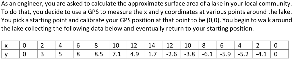
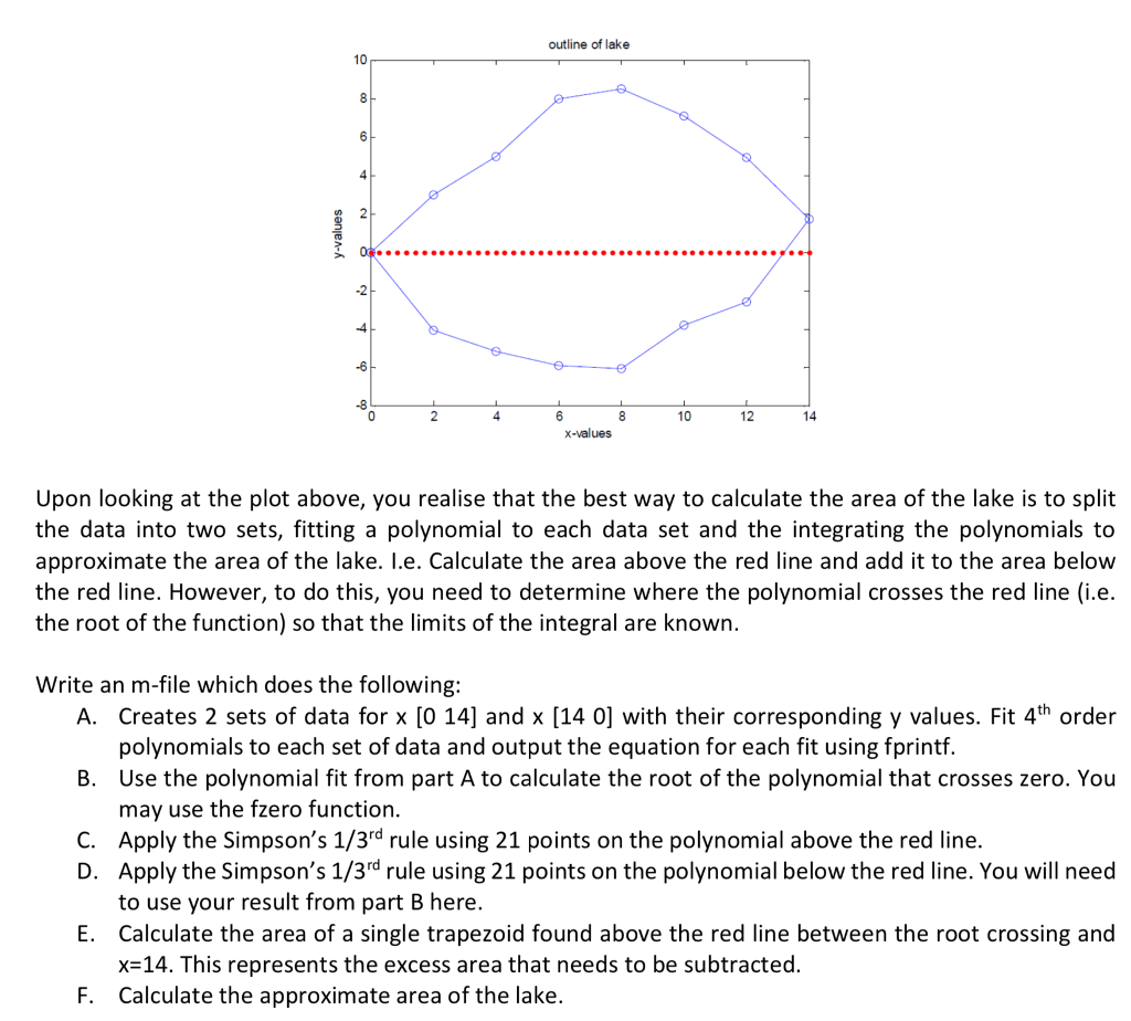
As an engineer, you are asked to calculate the approximate surface area of a lake in your local community. To do that, you decide to use a GPS to measure the x and y coordinates at various points around the lake. You pick a starting point and calibrate your GPS position at that point to be (0,0). You begin to walk around the lake collecting the following data below and eventually return to your starting position x02 46 810 1214 12 10 8 6 4 2o y 0 3 5 8 | 8.5 7.1 4.9 | 1.7 | -2.6 | -3.8 -6.1 | -5.9 |-5.2 |-4.1 | 0 As an engineer, you are asked to calculate the approximate surface area of a lake in your local community. To do that, you decide to use a GPS to measure the x and y coordinates at various points around the lake. You pick a starting point and calibrate your GPS position at that point to be (0,0). You begin to walk around the lake collecting the following data below and eventually return to your starting position x02 46 810 1214 12 10 8 6 4 2o y 0 3 5 8 | 8.5 7.1 4.9 | 1.7 | -2.6 | -3.8 -6.1 | -5.9 |-5.2 |-4.1 | 0
Step by Step Solution
There are 3 Steps involved in it

Get step-by-step solutions from verified subject matter experts